NASA’s New “Lunar Backpack” Can Generate a Real-Time 3D Terrain Map To Aid Moon

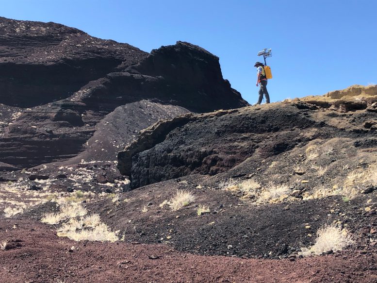
Michael Zanetti, a NASA planetary scientist at NASA’s Marshall Space Flight Center in Huntsville, Alabama, hikes the Cinder cone in Potrillo volcanic field in New Mexico in late 2021, testing the backpack-sized prototype for NASA’s Kinematic Navigational and Cartography Knapsack (KNaCK), a mobile lidar scanner now in development to support lunar exploration and science missions. Credit: NASA/Michael Zanetti
Consider a mountaineering expedition in a completely uncharted environment, where the hikers had the ability to generate a real-time 3D map of the terrain. Artemis-era explorers prepare to undertake the first modern missions to the Moon, and the first ever to its South Pole. The Sun never rises more than 3 degrees above the lunar horizon there, leaving much of the terrain in deep shadow. That makes distances to various points of interest difficult to eyeball.

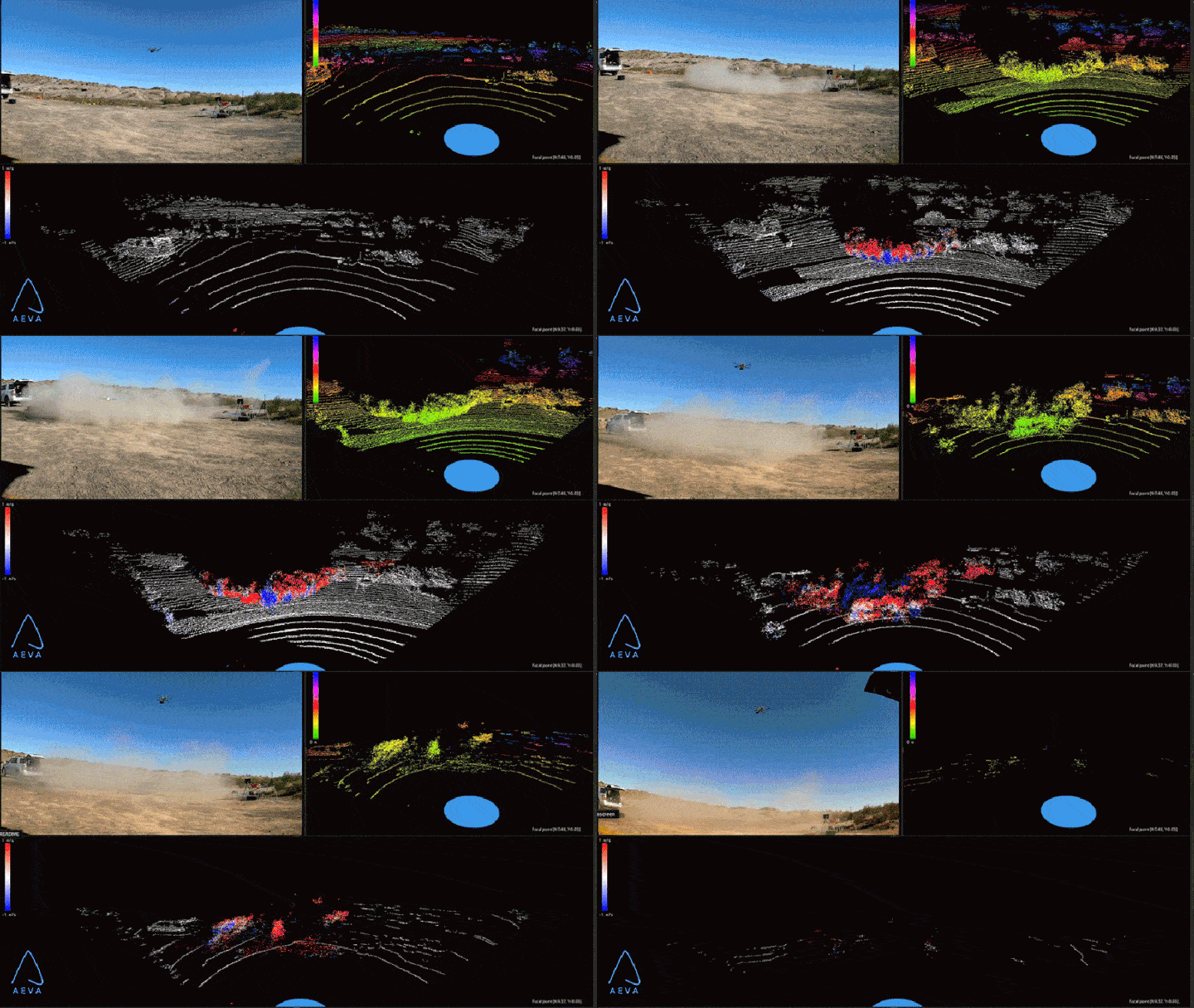
This video of a UAV drone landing in the dusty New Mexico desert demonstrates how the KNaCK technology – leveraging 4D FMCW-lidar data from NASA vendor Aeva Inc. of Mountain View, California – combines live, real-time high-definition video imaging, as seen at upper left panel; lidar ranging data, at upper right; and lidar Doppler velocity data. The latter tracks the speed and direction of dust particles kicked up by the descending drone, with red indicating particles moving away from the scanner and blue indicating those moving toward it. Such capabilities, now in development by researchers at NASA’s Marshall Space Flight Center in Huntsville, Alabama, could benefit future science missions on other worlds in addition to enabling real-time topographical mapping by explorers. Credit: NASA/Michael Zanetti
Initiated in 2020 with funding by NASA’s Early Career Initiative, the KNaCK project has partnered with Torch Technologies Inc. of Huntsville to develop the backpack prototype and associated navigation algorithms that permit accurate mapping without GPS. The project’s commercial vendor, Aeva Inc. of Mountain View, California, is supplying FMCW-lidar sensors and support, working with NASA to enhance the backpack’s lidar sensing system for use on the Moon and other extraplanetary human excursions.
Using KNaCK during rover excursions and when traveling on foot, explorers could precisely map the topography of the landscape, including deep ravines, mountains, and caves. Lidar even works in pitch blackness, relieving astronauts of the need to haul cumbersome lighting rigs everywhere they go.
“As human beings, we tend to orient ourselves based on landmarks – a specific building, a grove of trees,” Zanetti said. “Those things don’t exist on the Moon. KNaCK will continuously enable explorers traversing the surface to determine their movement, direction, and orientation to distant peaks or to their base of operations. They can even mark specific sites where they found some unique…
Read More:NASA’s New “Lunar Backpack” Can Generate a Real-Time 3D Terrain Map To Aid Moon
